|
PLACES AROUND WABAMUN LAKE |
|
INDEX - Whitewood Bay, Poole Sail Club, Coal Point, EYC & Seba, SBYC, Rosewood Bay, Sundance Canal, Iron Head Bay, Wabamun & Marina, Wabamun Canal, WSC, |
 |
AOSA
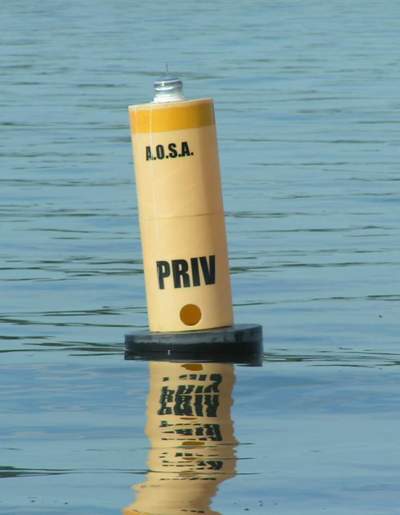
CARDINAL BUOYS - The AOSA deploys 2 cardinal buoys
around Wabamun Lake to keep boaters away from underwater hazards. We think you will appreciate them. Each buoy meets CCG
regulations with the following requirements:
CARDINAL BUOYS.
LEGAL STUFF - The Coal Point buoy is e/w a 20' rode and a few feet of chain secured with a 20 pound navy anchor. The Sunshine Bay entrance buoy is e/w a 10' rode and a few feet of chain secured with a 20 pound navy anchor. It is unlikely either anchor will move in a storm. However, since a buoy will move a bit with the wind, we try to position each anchor so it floats in a minimum of 10' deep water. This was done to ensure safe passage on the designated deep water side. We make many passes with a tracking depth sounder to determine the final resting spot of the anchor. This is a tricky manoeuvre with no reference mark at the end of a reef. Imperial units are shown here to match those on the AOSA chart. NOTE - There is no guarantee of location expressed or implied by the AOSA. For instance, if you slide alongside a buoy to "kiss" it with your hull, you are on your own if you hit bottom! If you use a buoy as a race marker, then pass the buoy with at least 10M radius on the designated deep water side. If you damage a buoy, the internal web camera will record the event and
you can expect to receive a bill! |
|
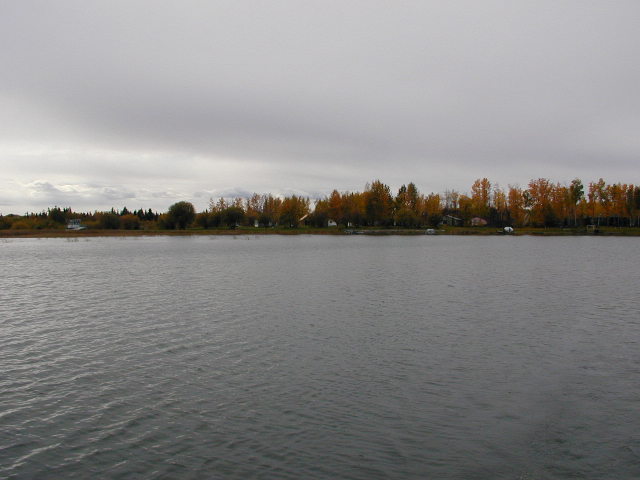
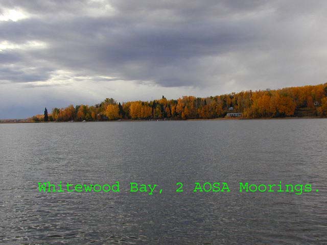 Located on the North shore of Wabamun, just east of Poole Sail Club. Very quiet with great weather protection from SW around to NE winds. - Nice secluded sandy beach. - Cell service here is a local call to Edmonton. NOTE - This is an old photo and AOSA no longer places moorings balls here. |
|
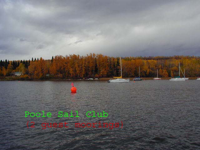
As of 2009 the Poole Sail Club no longer
exists, citing a liability issue with volunteers on the
property. |
|
WARNING - There is a shoal area that extends about 3/4 of a KM SE from Coal Point. The bottom consists of sand with some weeds on the Eastern side. The shoal shifts slightly each year due to wind and ice. It's just over a meter deep at the tip, after which it drops off sharply to 8 meters or more. To demonstrate how much the sand shifts, there used to be a deep water passage close to shore around 1985. It is now filled in. As of 2005 the AOSA installed an illuminated South cardinal buoy here. It floats in about three meter deep water. Don't use it for a race marker. It is a navigational hazard and should be given a wide berth to the South, through deep water.
The
Challenge - 50 roundings in a year of this
"fearsome peninsula" qualifies a skipper or crew for an ear
ring. All roundings MUST be within 10 meters of the cardinal buoy and the
keel must not touch the bottom. |
|
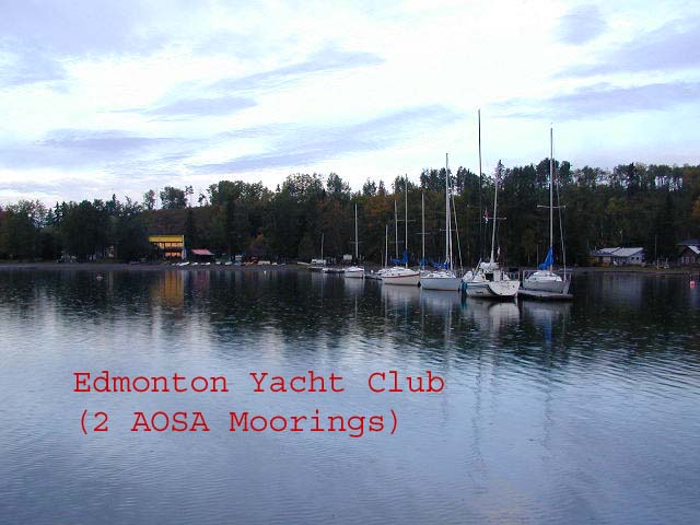
The summer village of Seba Beach is located at the west end of the
Wabamun Lake. The sandy beach extends along the entire water front of the village, from the
north to the south shores. It's very relaxing to cruise the length of this beach, watching the beach
traffic while they're watching you! There is plenty of water depth. After you're totally mellowed out,
anchor at EYC and walk into town for an ice cream cone under the cool trees. Sure
sounds tempting. |
|
|
|
A small bay tucked into the
south west corner of the lake. This bay offers good weather protection
for all wind directions except from the west. In this case, if it really
decides to blow, it's best to move
to the small bay west of the creek, adjacent to the Seba
Beach shore.
NOTE - This is an old photo and
AOSA no longer places moorings balls here. |
|
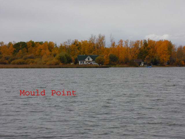
Rosewood Bay is located on the south shore of Wabamun Lake immediately to the east of Mold Point and Beaver Bay. The bay provides natural shelter from the southeast through northwesterly wind directions and the average water depth in the west half is about 8 feet. This is where Beaver Creek flows into the bay, from the southwest. The east half of the bay is shallower, about four and a half feet deep, and better left to the local boats that moor here. There is a long rock reef that extends across the eastern mouth of the bay and ends at about the center. Fixed keel vessels should proceed with caution when entering the bay. It is safe to make your approach through the west third of the bay, adjacent to the Mold Point side.
The bay is flanked by the cottage communities
of Beaver Hill Estates to the west and Rosewood Beach to the south, both
of which are very active in the summer. It is the seasonal and year round home to several cruising sailors. Local
residents are quite approachable and willing to help in the event of a
problem. The reeds around the bay are home to loons, herons and many
other birds. They also offer some of the
best pike fishing in the lake. |
|
|
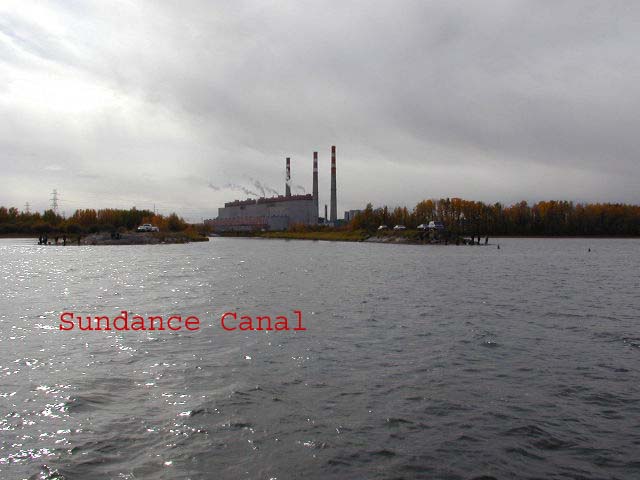
- South Shore, (As of 2018 there are rumours this channel may be
reopened in 2020)
IF THE CHANNEL OPENS AGAIN - Make your approach straight into the channel, "crab" if have to, to avoid the underwater debris on either side of the mouth. In 2001 Trans-Alta started pumping water into the lake to offset losses into the mine. In 2002 the volume increased significantly so there is now current flowing into the lake. There are floating marker cans to warn you, just down stream of the pipes. It is best to enter with a warm engine. This water is crystal clear. Great place to check the hull. There is a small dock adjacent to the launching ramp and an outhouse and picnic tables are only a short walk away. The ramp has a drop off at the end which makes it very difficult to retrieve a larger sailboat. So keep your trailer wheels on the cement slabs, don't let them drop off the end. The public ramp at the Town of Wabamun is much longer and is sheltered from a west wind. WARNING - The best way to tie
your boat to shore is to drive a stake in the ground, over the top of
the bank well down the slope on
the far side. Another method is to carry your anchor over
the bank and set the flukes into the dirt. Your choice. |
|
| This bay affords surprisingly good protection from north east winds.
Cell service here is a
local call to Edmonton. |
|
|
|
|
WARNING -
With the Wabamun Power plant gone there is no current in
the
Wabamun inlet canal. However
you should enter the canal with caution
and maneuver with a warm engine. As soon as you pass the mouth of the
canal cut your throttle to idle to control speed. The standard technique for turning
in the tight channel is
to nudge the bow into the bank, very slowly, use the engine to push the stern
sideways,
back off from the bank and throttle up to maneuver to your spot. In addition, have your anchor
ready to stop your boat. Now that would be a nasty way to end a day! Use a couple of long mooring lines to tie your boat around the base
of the most substantial bush you can find. One at the bow to keep the
boat pointed slightly into the bank and one at the stern to pull the cockpit
to shore for boarding. If your lines cross the foot path, keep them on
the ground so you don't
trip any sleepy early morning fisherman. Better yet, mark them to
improve the visibility. To say there are mosquitoes here is
the understatement of the year, so use a bug net in the companionway and
hatch. Yet there are lots of times when you can't find a bug in the
place. Welcome to Canada. Cell
service here is a local call to Edmonton. |
|
| Located on the North shore of Wabamun about 1 KM east of the Wabamun power plant. This club launches its dinghies from the each. The water at the end of the pier is not deep enough for a cruiser. Best to anchor and row your dinghy to shore. WSC web site. Cell service here is a local call to Edmonton. |
|
 Ballasted to stay upright in a storm for maximum
visibility. (mandatory)
Ballasted to stay upright in a storm for maximum
visibility. (mandatory) 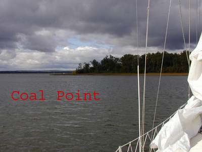
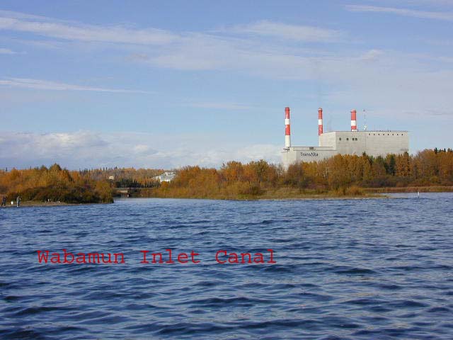 This inlet canal is a great place to
"tuck into" during a storm or to spend a peaceful night. Make
your approach straight down the center, even if you have to
"crab" to off set a side wind.
This inlet canal is a great place to
"tuck into" during a storm or to spend a peaceful night. Make
your approach straight down the center, even if you have to
"crab" to off set a side wind.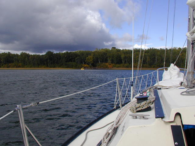